 Objectives
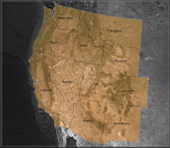
Objective Wildfire frequency and area burned has been increasing over the past decades. These trends were characterized by Davis and Weber (2018). The research described in this paper relied upon The Historic Fires Database (HFD). The HFD was created at ISU's GIS TReC through support of a NASA Applied Sciences Grant (NNX12AQ78G); the NASA RECOVER project. The HFD was assembled by acquiring wildfire perimeters from authoritative sources across the western US. This included the US Forest Service (USFS), Bureau of Land Management (BLM), US Geologic Survey (USGS), National Interagency Fire Center (NIFC), as well as state agencies like Idaho Department of Lands (IDL) and the California Department of Forestry and Fire Protection (CalFire). These data were carefully examined to ensure the resulting database did not contain duplicate fire polygons and that it was as comprehensive and complete as possible. As one would expect, documentation of older wildfires became increasing difficult to obtain and more uncertain. While some regions seemed to have good documentation of fires even into the 19830's and 40's, this was not consistent across the entire study area. For this reason, a decision was made to begin the HFD record in 1950.

Today, the HFD continues to be maintained by ISU's GIS TReC with new editions becoming available early in the spring of each year. The HFD is stored in geodatabase format and requires GIS software to open/read these files. The HFD is made freely available. To obtain a copy of these data visit the data download page.